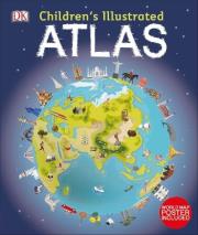
Children's Illustrated Atlas
Wydawca:
DK
wysyłka: niedostępny
ISBN:
9780241228074
EAN:
9780241228074
oprawa:
Twarda
format:
26.0x31.0cm
język:
angielski
liczba stron:
128
rok wydania:
2019
(0) Sprawdź recenzje
19% rabatu
58,45 zł
Cena detaliczna:
72,35 zł
dodaj do schowka
koszty dostawy
Najniższa cena z ostatnich 30 dni: 58,60 zł
Opis produktuZasady bezpieczeństwa
DK's Children's Illustrated Atlas brings geography to life; packed with more than 50 colourful maps for kids and fascinating facts about the countries of the world.
Each map is bursting with information, such as climates, populations, famous sites, mountains and rivers, and natural wonders of the world. The atlas also includes a world map, with a political map for each continent. Through each map children are shown how to read a map and use a key, compass and scale.
Charming and informative, the Children's Illustrated Atlas is a key addition to every child's library.
x

Uwaga!!!
Ten produkt jest zapowiedzią. Realizacja Twojego zamówienia ulegnie przez to wydłużeniu do czasu premiery tej pozycji. Czy chcesz dodać ten produkt do koszyka?
TAK
NIE

Wybierz wariant produktu
|


